26/07/2022-01/08/2022

OnWheels map in MapComplete [1] | © MapComplete | map data © OpenStreetMap contributors
Breaking news
- The OpenStreetMap project will turn 18 on or around Tuesday 9 August 2022. If you have a birthday event to announce or want to post photos from your celebrations you can add them to the wiki page.
Mapping campaigns
- An item, in last week’s weeklyOSM, about classifying data quality in OSM triggered a brief discussion on the HOT talking list.
- People from TomTom have put together a series of MapRoulette tasks and shared them with the Chilean, Maltese, Slovenian, and other communities. Elsewhere, TomTom’s own editing has been criticised for making incorrect edits.
Mapping
- Anne-Karoline Distel published new videos describing how to map thatched roofs and how to tag a variety of
roof:materialon the one building. - Patrik_B shared his workflow and tips for validating multiple tasks at once using JOSM and a number of plugins.
Community
- The next OSM-FOSSGIS community meeting is planned
![(de)]() >
> ![en]() to be held on the weekend of 16 to 18 September at the Linuxhotel in Essen. Travel is at your own expense; accommodation and meals will be provided by the the FOSSGIS Association, the German local chapter of OSM.
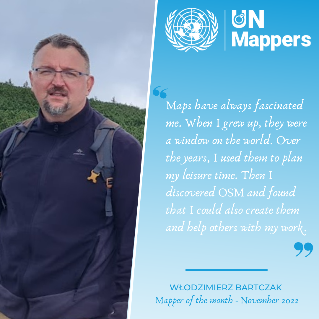
to be held on the weekend of 16 to 18 September at the Linuxhotel in Essen. Travel is at your own expense; accommodation and meals will be provided by the the FOSSGIS Association, the German local chapter of OSM. - User AwoowoArne, from Germany, is the UN Mapper of the Month.
 >
> 
OpenStreetMap Foundation
- The OWG, the operational group that manages the OSMF servers, showed the board-approved version of their 2022 (Q3–Q4) budget.
- The OSMF Board is running an ‘Ask Us Anything’ at SotM, and is looking for questions.
Local chapter news
- OpenStreetMap US’s July newsletter has been published.
- OpenStreetMap Poland has signed
![(pl)]() >
> ![en]() a cooperation agreement with the Internet portal gisplay.pl
a cooperation agreement with the Internet portal gisplay.pl ![(pl)]() which will promote OSM and modern map solutions based on OSM data.
which will promote OSM and modern map solutions based on OSM data.
 >
> Events
- The OpenSteetMap community in Kerala held their Meetup 2022, which took place on Sunday 31 July in Kochi. Around 30 mappers across Kerala state participated. Presentations and hands-on sections on were devoted to mapping public transport and local government bodies.The meeting was reported by The Hindu, and Florian Lainez, of Jungle Bus, tweeted highlights of the day.
OSM research
- Mohammed Rizwan Khan reported on the development of a lite-mode ohsomeHeX application for smaller-screen mobile devices. Though the application will have limited functionality on smaller screens, it will still allow mobile users to get an overview of current OSM topics on the go.
switch2OSM
- Luxembourg’s Foreign Minister Jean Asselborn is cycling from Luxembourg to Saint Maxime, in Provence (over the top of Mont Ventoux!), and he used OpenStreetMap to plan his journey.
- New instructions for setting up a rendering server on Ubuntu 22.04 were published when that version of Ubuntu was released. In a diary entry, SomeoneElse explained that setting up replication with
osm2pgsqlorPyOsmiumand monitoring withmuninis much easier now, as Ubuntu provides up to date packages forosm2pgsqlandosmium, so that a manual build from source is not needed any more.
Software
- ChrisPark blogged a Google Summer of Code midterm update for their goal of reintroducing transit to Valhalla, an open-source routing engine.
- The OpenStreetMap Ops Team has published post-mortem reports about two recent service outages: the longest outage in 5+ years, and a degraded standard tile layer incident.
Programming
- Roland Olbricht has released Docker containers to run the Overpass API. Instructions for installing these are available here.
Releases
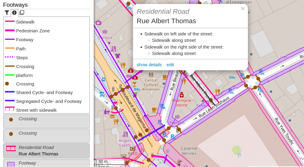
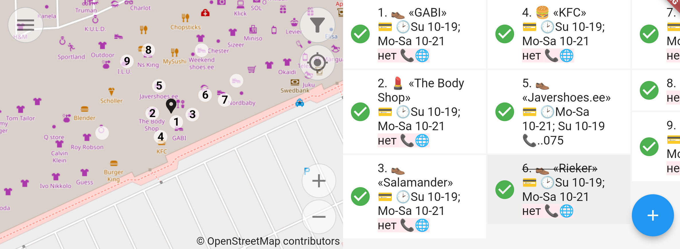
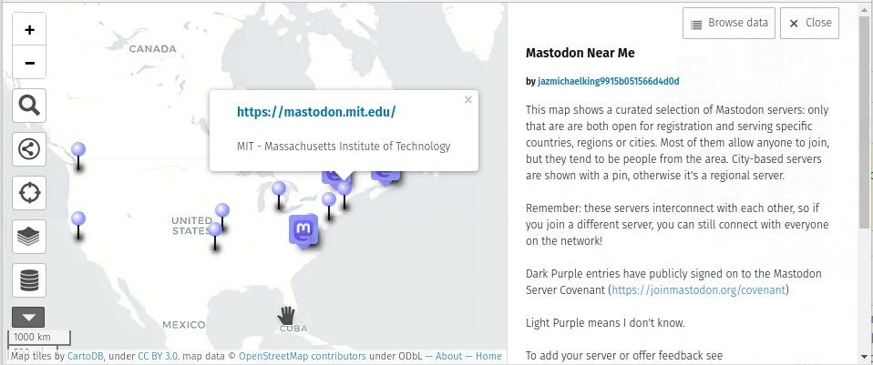
- [1] Pieter Vander Vennet has added another map to the 46 themes at MapComplete, the OnWheels map. In his blog post, Pieter tells how he and four students, funded by Open Knowledge in Belgium, implemented the OnWheels project as part of their Open Summer of Code and created a special map for wheelchair users.
Did you know …
- … we left some options out in last week’s list of tools for contributing to OSM? Go Map!! is available on iPhone (thank you for the kind comments from @Notna M and @Tordans) and OsmApp for Android, iOS and Web. Felipe says on Telegram ‘On Chrome, Firefox and Safari you can download the Progressive App directly from its page’. We also recommend checking Wambacher’s SoftwareWatchlist.
- … all the best alternatives to the various Google services? This list
![(fr)]() >
> ![en]() , by the French Clubic web magazine, contains a section about Google Maps alternatives. OpenStreetMap and its ecosystem are placed at the top of the list of alternatives.
, by the French Clubic web magazine, contains a section about Google Maps alternatives. OpenStreetMap and its ecosystem are placed at the top of the list of alternatives.
 >
> Other “geo” things
- Plan4Better has used their Geo Open Accessibility Tool (GOAT) to see how close Munich is to being a 15-minute city.
Upcoming Events
| Where | What | Online | When | Country |
|---|---|---|---|---|
| Csömör | OSM 18th birthday hiking & survey in Csömör  |
2022-08-06 |  |
|
| Cayambe | Notathon en OpenStreetMap – resolvamos notas de Cayambé, Ecuador |
2022-08-06 |  |
|
| OSM Africa August Mapathon: Map Rwanda |
2022-08-06 | |||
| 新北市 | OpenStreetMap 街景踏查團 #3 |
2022-08-07 |  |
|
| Washington | MappingDC Mappy Hour |
2022-08-10 |  |
|
| Hamburg | Hamburger Mappertreffen |
2022-08-09 |  |
|
| Köln | 25. Stammtisch Köln |
2022-08-10 | |
|
| Salt Lake City | OSM Utah Monthly Meetup |
2022-08-11 | |
|
| München | Münchner OSM-Treffen |
2022-08-10 | |
|
| Zürich | 143. OSM-Stammtisch |
2022-08-11 |  |
|
| Berlin | 170. Berlin-Brandenburg OpenStreetMap Stammtisch |
2022-08-12 | |
|
| Perth | Social mapping Sunday: Claisebrook to Optus Statium |
2022-08-14 |  |
|
| Windsor | StreetComplete Group Quest |
2022-08-16 |  |
|
| OSMF Engineering Working Group meeting |
2022-08-15 | |||
| 臺北市 | OpenStreetMap x Wikidata Taipei #43 |
2022-08-15 | |
|
| San Jose | South Bay Map Night |
✓ | 2022-08-17 | |
| 154. Treffen des OSM-Stammtisches Bonn |
2022-08-16 | |||
| Lüneburg | Lüneburger Mappertreffen (online) |
2022-08-16 | |
|
| Firenze | State of the Map 2022 |
2022-08-19 – 2022-08-21 |  |
|
| Firenze | FOSS4G 2022 |
2022-08-22 – 2022-08-28 | |
|
| Bremen | Bremer Mappertreffen (Online) |
2022-08-22 | |
|
| City of Nottingham | OSM East Midlands/Nottingham meetup (online) |
✓ | 2022-08-23 |  |
| City of Nottingham | OSM East Midlands/Nottingham meetup (online) |
✓ | 2022-08-23 | |
| IJmuiden | OSM Nederland bijeenkomst (online) |
✓ | 2022-08-24 |  |
Note:
If you like to see your event here, please put it into the OSM calendar. Only data which is there, will appear in weeklyOSM.
This weeklyOSM was produced by MatthiasMatthias, PierZen, SK53, SomeoneElse, Strubbl, TheSwavu, conradoos, derFred.
 voice /
  subtitles) a thatch map on uMap is now available, which completes the videos we
  ►
► 


 /
/ ►
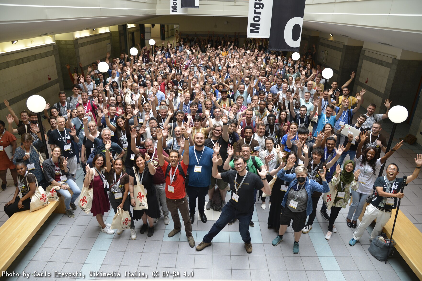
►  about the OSM Spain community present at State of the Map 2022, in Florence, Italy.
 ►
► 


 ►
►  ►
► 


 a podcast about OSM mapping for Situ/lake conservation in Jabodetabekpunjur, Indonesia.
 ►
► 


 >
> 
 that SotM Japan 2022 will be held on Saturday 3 December in Kakogawa, Hyogo.


 ►
► ►
► ►
►


 Lake Itasy |
  Lac Itasy |
  Farihy Itasy
 @andrewdc_nz *

 @lucasdestrem@mapstodon.space @LucasDestrem *
 ►
► @MapsByAntonia *