07/03/2023-13/03/2023
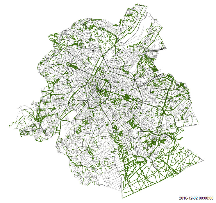
mapping roads in Brussels [1] | © Road completion project | map data © OpenStreetMap contributors
Mapping
- Jake Coppinger shared details on how you can create your own aerial imagery and 3D models of streets with the built-in iPhone LiDAR sensor (iPhone Pro 12 or later, 2020+ iPad Pro) and open source tools in the OpenDroneMap package. All you need to do to capture the model is walk around with your iPhone at ground level.
- Valerie Norton elaborated on her tagging issues in a national park. While normally mappers should stick to what can be surveyed in the real world, she argued that existing rules must also be considered. Some examples are service roads inaccessible to the public, or no dogs, no matter what you see people actually doing.
- The proposed feature
emergency=air_rescue_servicehas been approved with 20 votes for, 2 votes against and 0 abstentions.
Community
- Celebrating International Women’s Day, the OpenStreetMap Blog put Geoladies PH in the spotlight – the Philippine Geoladies group.
- Pieter Vander Vennet presented some statistics from the MapComplete user survey. They include demography, computer and OSM knowledge, used themes, and feature requests.
- The old OpenStreetMap forum has now been migrated to OSM Community. Old forum links are still valid and redirect to the imported content.
- Matt Whilden is using Google Alerts to learn when town councils, or other agencies, plan to rename particular features. He encourages users to monitor the news with filters like ‘road rename’ to detect items needing updates in OSM.
OpenStreetMap Foundation
- Steve Coast posits that the OpenStreetMap Foundation has critically failed and needs a ‘reboot’. There is a poll on Twitter asking if you agree or disagree.
Local chapter news
- Joost Schouppe announced the official launch of the OSM Belgium Traffic Sign Project. It uses a continually updated traffic sign dataset from Flanders, Belgium to automatically create MapRoulette tasks to map the effect of newly digitised (and usually newly placed) traffic signs. The project was brought from proof of concept to production with help from TomTom engineers. As with similar OSM Belgium projects, it should be easy to integrate other datasets into the workflow.
- Minh Nguyen, outgoing president of OSM US, guest blogged about how the National Transportation Safety Board (NTSB) recognised communities’ efforts to ensure that railway level crossings are accurately mapped. NTSB originally wrote to OSMF, and a number of other providers of data for satnav routing, after a serious accident at a level crossing in California in 2015 (we reported earlier in #341 and #486).
- OSMCha is almost eight years old now. Running without consistent maintenance since June 2021, OpenStreetMap US has just accepted it as a charter project along with MapRoulette. Wille Marcel noted that this partnership will provide the structure to raise funds for development and hosting, and will also open the possibility for the entire OSM community to influence the future of OSMCha (Wille is the creator of OSMCha).
Events
- This year OSM Hack Weekend Berlin is taking place on 15 and 16 April. More information can be found on the OSM wiki.
OSM research
- HeiGIT announced that its ohsome R package has finally landed on CRAN. This makes it easier to analyse the rich data source of OSM history using R. You can specify your own temporal, spatial and/or thematic filters and request aggregated statistics on the evolution of OSM elements. The package can now be installed directly from CRAN.
Maps
- Paul Norman has published a new map style called Street Spirit. Its aim is to be used as a locator map. The source code is available on GitHub and a demo can also be explored.
- Amazon Web Services has announced the Open Data Maps option for Amazon Location Service, which is based on OpenStreetMap data.
- Mark Stosberg has proposed metrics for measuring where pavements (sidewalks) are most needed, based on the idea of the 15 minute neighbourhood. The code is available on GitLab for perusal.
Software
- BuntingLabs has launched an API to get map data from OSM. In their blog, they explained why it is easier to use than other existing APIs, such as overpass turbo.
- OsmAnd blogged about different terrain themes and how they can be styled in their app.
Programming
- Daniele Santini released OSM-Wikidata Map Framework, which can be used to create interactive maps that display details about entities associated with geographic features from OpenStreetMap and/or Wikidata. The types of features and entities to show are chosen by editing a configuration file and are automatically handled by the framework. The first maps to use it are Open Burial Map (shows details about people at their burial place) and Open Etymology Map (from which the framework was derived).
- For those of you who develop software that interacts with the OSM API, Paul Norman reported that the Operations Working Group is considering deprecating HTTP Basic Auth and OAuth 1.0a in favour of OAuth 2.0 on the main API, in order to improve security and reduce code maintenance.
Releases
- Organic Maps has released a new version, which features UI fixes for iOS and Android. Maps have been updated to 27 February, medicine POIs are split into several types, and more.
Did you know …
- [1] … the Belgian road completion project? It uses open government datasets to verify and detect missing data in OSM. In return, it improves the government data as well.
- … WhatIsWhere helps you to create queries like overpass turbo without a complex query language?
OSM in the media
- Frédéric Rodrigo (Osmose-QA maintainer) explored the subject of synchronising a copy of OpenStreetMap data while trying to ensure the quality of the copy. The article studies existing tools and strategies.
Other “geo” things
- heise reported
![]() ►
►![]() on a project in which researchers are counting (with AI support) every single tree in a wide area of northern Africa.
on a project in which researchers are counting (with AI support) every single tree in a wide area of northern Africa. - Jens Wiesehahn has created a topographic map of Germany showing soil texture, which can be viewed on Twitter.
 ►
►
Upcoming Events
| Where | What | Online | When | Country |
|---|---|---|---|---|
Let’s DigitAll for Women  |
2023-03-08 – 2023-03-22 | |||
| Berlin | FOSSGIS Konferenz 2023 |
2023-03-15 – 2023-03-18 |  |
|
| Berlin | Missing Maps Mapathon in Berlin |
2023-03-18 | |
|
| Toulouse | Réunion du groupe local de Toulouse |
2023-03-18 |  |
|
| Fort Collins | A Synesthete’s Atlas – Eric Theise & Brett Darling (aka Spider Lights) |
2023-03-19 |  |
|
| 左京区 | うさぎの神社をデジタルアーカイブ! |
2023-03-19 |  |
|
| Grenoble | Découverte d’OpenStreetMap |
2023-03-20 | |
|
| OSMF Engineering Working Group meeting |
2023-03-21 | |||
| Lyon | Réunion du groupe local de Lyon |
2023-03-21 | |
|
| 161. Treffen des OSM-Stammtisches Bonn |
2023-03-21 | |||
| City of Edinburgh | OSM Edinburgh Social |
2023-03-21 |  |
|
| Lüneburg | Lüneburger Mappertreffen (online) |
2023-03-21 | |
|
| Formação UN Mappers: OpenStreetMap e o mapeamento humanitário – sessão 1 |
2023-03-22 | |||
| Tiranë | OSM Albania – Mobilizing to map Malawi |
2023-03-22 |  |
|
| Formation UN Mappers : OpenStreetMap et la cartographie humanitaire – session 8 |
2023-03-23 | |||
| Denver | A Synesthete’s Atlas – Eric Theise & Carl Ritger |
2023-03-24 | |
|
| iD monthly meetup |
2023-03-24 | |||
| Nantes | Découverte du projet cartographique OpenStreetMap |
2023-03-25 | |
|
| Shire Of Mundaring | Social Mapping Sunday: Lake Leschenaultia |
2023-03-26 |  |
|
| Bremen | Bremer Mappertreffen (Online) |
✓ | 2023-03-27 | |
| San Jose | South Bay Map Night |
✓ | 2023-03-29 | |
| Formação UN Mappers: OpenStreetMap e o mapeamento humanitário – sessão 2 |
2023-03-29 | |||
| Brno | Missing Maps Brno mapathon March 2023 |
2023-03-29 |  |
|
| Formation UN Mappers : OpenStreetMap et la cartographie humanitaire – session 9 |
2023-03-30 | |||
| Düsseldorf | Düsseldorfer OpenStreetMap-Treffen |
2023-03-31 | |
|
| MapRoulette Monthly Community Meeting |
2023-04-04 | |||
| Missing Maps London Mapathon |
2023-04-04 | |||
| Formação UN Mappers: OpenStreetMap e o mapeamento humanitário – sessão 3 |
2023-04-05 | |||
| Madison | A Synesthete’s Atlas – Eric Theise & upright bassist Ari Smith |
2023-04-06 | |
|
| Stuttgart | Stuttgarter Stammtisch |
2023-04-05 | |
Note:
If you like to see your event here, please put it into the OSM calendar. Only data which is there, will appear in weeklyOSM.
This weeklyOSM was produced by ChristopherGS, MatthiasMatthias, SK53, Strubbl, TheSwavu, YoViajo.
We welcome link suggestions for the next issue via this form and look forward to your contributions.